
Cleveland in 50 Maps
An amazingly detailed and quirky collection of maps about Cleveland, AKA, the Forest City.
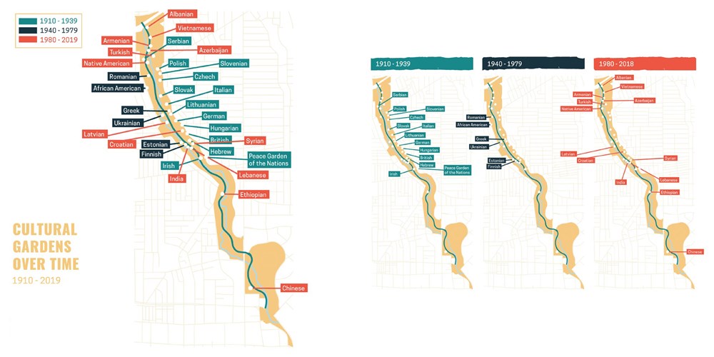
"Follow the changing locations of breweries, music venues, and commuter rail lines over time. Track the Clinic’s growing east side footprint, year-by-year attendance at the Jake, and the addition of communities to the Cultural Gardens. Find out which local high schools produce the most NFL players and which locations the major presidential candidates visited in 2016. Discover the massive salt mine under Lake Erie and the barricades on the border of Shaker Heights. In each colorful map, you'll find a new perspective on one of America’s most misunderstood cities and the people who live here."
You must log in to comment.
